Block Island Wind Farm turbine foundation during the construction phase.
INSPIRE Staff Rich Balouskus, Jeanine Boyle, Drew Carey, and Kersey Sturdivant attended the American Wind Energy Association’s (AWEA) Offshore Windpower conference in Washington, D.C. last weekend, promoting our expertise in offshore wind seafloor reconnaissance and fisheries assessment. Our Sediment Profile Imaging (SPI) camera is a proven and regulatory agency recommended alternative to traditional benthic sampling methods, with the unique ability to visualize the seafloor for communication with key stakeholders, and we were glad to share our expertise with major stakeholders in a key period of offshore wind development.
Rich, Kersey, and Drew manning the booth at AWEA Offshore Windpower 2018.
INSPIRE has conducted research for existing and planned Deepwater Wind developments. Research includes but is not limited to: Benthic Habitat Assessment, G&G Groundtruthing, Visualization, Demersal Fish Trawls, Fisheries Expert Consultation, Lobster and Cod Spawning Surveys, COP Writing and Review, Agency Consultations, and Community Stakeholder Outreach. We provide in-depth knowledge on identifying suitable areas for offshore wind development (both turbine and cable placement) and on permitting to develop in these areas. Our expertise has been honed from our extensive experience working for Deepwater Wind, Ørsted, and NYSERDA. AWEA Offshore Windpower was an exciting opportunity for INSPIRE to contribute to this burgeoning industry and to showcase the work that we have done to date.
INSPIRE Project Scientist Marisa Guarinello is headed to Hawai’i, where she will be talking Sediment Profile Imaging (SPI), sediment, and dredged material ecosystems impacts.
Marisa Guarinello will be presenting at the WEDA Pacific Chapter Fall 2018 conference in Honolulu, HI, at the Hilton Waikiki. She will present her talk, “Imagery reveals confounding factors in evaluation of dredged material at the Nawiliwili ODMDS off the coast of Kauai”, during the Wednesday October 24 afternoon session on Environmental/Beneficial Use; she presents on behalf of Allan Ota (US EPA Region 9), Brian Ross (US EPA Region 9), Scott Libby (Battelle), and Drew Carey (INSPIRE). Reach her here to connect before the conference!
The Department of Geophysical Sciences at the University of Chicago is hosting Dr. Sturdivant October 11th and 12th as he discusses careers after graduate school with students and presents work on macrobenthic recovery after disaster. Specifically, Dr. Sturdivant will present “The untold story of recovery following the Deepwater Horizon incident: A worm’s eye view,” which details how traditional benthic sampling missed the rapid recovery process following the Deepwater Horizon oil spill in 2011 and highlights benthic community resiliency. “Human understanding of the deep-sea benthic environment has always been limited by our ability to sample it,” Sturdivant notes, “as a result, deep-sea benthic ecology has a long history of mischaracterization ([as evidenced by] Edward Forbes’ [superceded] azoic theory).” Dr. Sturdivant hopes this story of deep-sea recovery serves “as a cautionary example for future deep-sea assessments, especially in areas impacted by anthropogenic activity.”
A SPI Image from an early survey profiles the seafloor and provides new insights into benthic resilience after an oil spill.
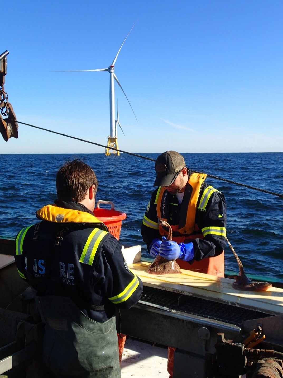
Eva Botkin-Kowacki/The Christian Science Monitor. From left, scientists Steve Sabo, Brian Jenkins, and Matt Griffin count and measure fish in a survey around the Block Island Wind Farm on Aug. 16, 2018.
Christian Science Monitor recently recognized INSPIRE’s involvement with the Deepwater Wind Block Island Wind Farm. In an article highlighting the collaborative effort of fishermen and wind farm developers throughout project implementation, INSPIRE’s trawlers feature as an example of partnership between scientists and stakeholders. INSPIRE worked with local fishermen to design and execute a survey that would assess how offshore wind farm construction and operation affect fish stocks, and we’re grateful to have had the chance to work with them!
INSPIRE staff attend to a deployed SPI camera off the waters of Hawai’i. (Photo credit: INSPIRE Environmental)
Marisa Guarinello of INSPIRE Environmental will be presenting the results of INSPIRE’s sediment profile and plan view imaging survey of the Nawiliwili Ocean Dredged Material Disposal Site in Hawai’i at the Western Dredging Association’s Conference in October 2018. Marisa will also briefly cover results from the Kahului and Port Allen sites, which INSPIRE also surveyed for the U.S. Environmental Protection Agency in October 2017. At the Nawiliwili site, the team had to account for surprising results in seafloor images, including large volcanic features and coarse coralline material throughout the site in assessing the dredged material footprint. At the time of site designation in 1981, available low-resolution bathymetric contours depicted a relatively uniform seafloor. High-resolution bathymetric data from 2017 revealed a large volcanic feature in the southeastern portion of the site that was confirmed with INSPIRE’s imagery.
A SPI image of an unexpected volcanic rock feature on the seafloor. While previous bathymetric surveys depicted a relatively smooth seafloor, INSPIRE found quite the opposite. (Photo credit: INSPIRE Environmental)
INSPIRE’s innovative visualization tools were instrumental in interpreting and presenting these confounding variables to allow for a clear understanding of features at the Nawiliwili site. In addition to the scope of the initial project, INSPIRE used archival data from 2013 surveys of the South Oahu and Hilo sites to create a complete Popup visualization of all five Hawaiian sites. Integrating all five sites into a single map environment, INSPIRE’s visualization provided crucial conceptual models to describe results of dredged material placement and serve as a valuable communication tool for the U.S. Environmental Protection Agency (EPA) as they determine best future uses of all sites and communicate with the public. Marisa is eager to share INSPIRE’s work on dredging in Hawai’i while she is actually in Hawai’i, co-authoring the presentation with counterparts from Battelle and the EPA.
Marisa Guarinello will be presenting at the WEDA Pacific Chapter Fall 2018 conference in Honolulu, HI, at the Hilton Waikiki. She will present her talk, “Imagery reveals confounding factors in evaluation of dredged material at the Nawiliwili ODMDS off the coast of Kauai”, during the Wednesday October 24 afternoon session on Environmental/Beneficial Use; she presents on behalf of Allan Ota (US EPA Region 9), Brian Ross (US EPA Region 9), Scott Libby (Battelle), and Drew Carey (INSPIRE). Reach her here to connect before the conference!
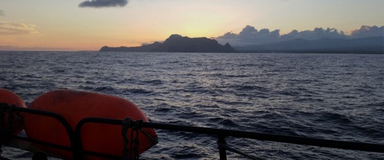
Above: INSPIRE staff conduct the monthly fish trawl survey for Deepwater Wind near Block Island, Rhode Island 2018 (Photo credit: INSPIRE Environmental).
INSPIRE Environmental is headed South! We are new collaborators with Harbor Launch, a start-up and small business incubator for science and science support companies. Harbor Launch is connected with the University of Maryland Institute of Marine and Environmental Technology and its network of innovative research scientists. With a dedicated wet lab and co-working office space in Baltimore’s Inner Harbor, INSPIRE can now support Deepwater Wind exploration in the mid-Atlantic.


