Mapping Deep-Sea Drilling Impacts
Mapping Deep-Sea Drilling Impacts
Ghana, Africa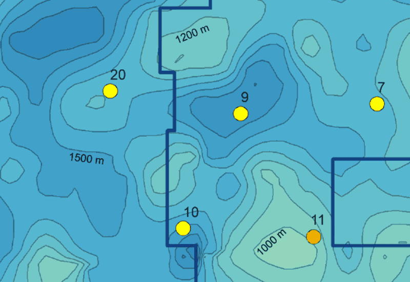
Offshore oil/gas exploration and production platforms can produce drilling mud discharges that alter seafloor conditions. An oil and gas company commissioned studies around four wellheads to map the extent and thickness of drilling mud deposits on the seafloor and benthic invertebrate recolonization in areas where deposits were detected. The project required a rapid turnaround time, making the application of SPI the ideal method for this deep-sea reconnaissance project (compared to traditional benthic sampling using grabs and coring).
Adapting quickly to new working conditions, INSPIRE designed and implemented a combined SPI and PV imaging survey in 1200 meters of water off the coast of Ghana from a Floating Production Storage and Offloading vessel. This project was part of a multidisciplinary monitoring program; rapid analysis of SPI results provided feedback to optimize direct sampling. Project design was driven by baseline surveys conducted by INSPIRE at the well-field five years prior.