Publications
Expertise
Sector
Publications |
7.11.25
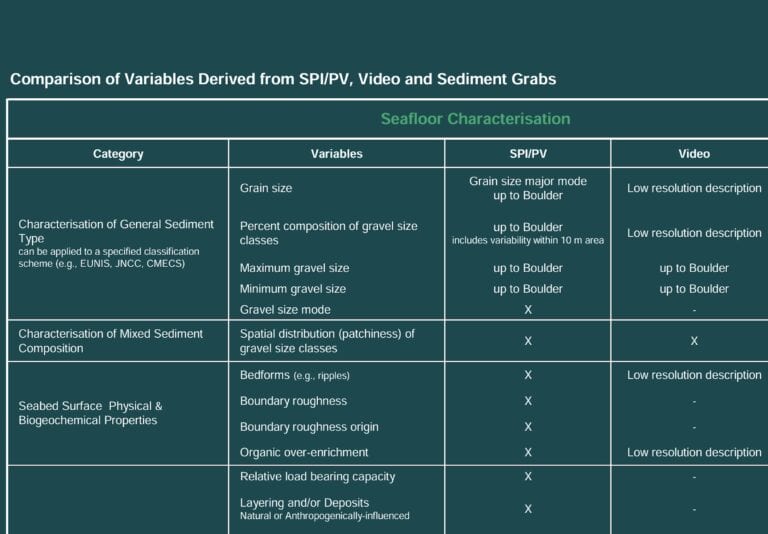
Comparison of Variables Derived from SPI/PV, Video and Sediment Grabs

Publications |
7.11.25
Benthic Procurement Strategy

Brochures |
7.11.25
Innovative Benthic Surveying
Story Maps |
2.17.25
Operations and Marine Resource Monitoring
Publications |
12.18.24
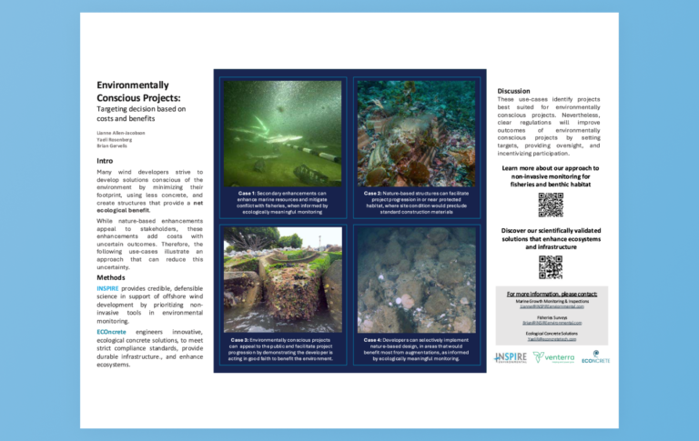
Environmentally Conscious Projects
Latest News


Publications